


Metz Voting District, Manassas city, Virginia
About
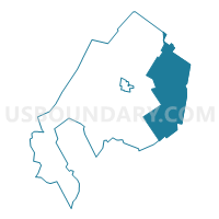
Outline

Summary
| Unique Area Identifier | 682948 |
| Name | Metz Voting District |
| County | Manassas city |
| State | Virginia |
| Area (square miles) | 1.89 |
| Land Area (square miles) | 1.88 |
| Water Area (square miles) | 0.01 |
| % of Land Area | 99.70 |
| % of Water Area | 0.30 |
| Latitude of the Internal Point | 38.75163030 |
| Longtitude of the Internal Point | -77.45803230 |
Maps


Graphs
Select a template below for downloading or customizing gragh for Metz Voting District, Manassas city, Virginia


Neighbors
Neighoring Voting District (by Name) Neighboring Voting District on the Map
- Baldwin Voting District, Manassas city, VA
- Buckhall Voting District, Prince William County, VA
- Dean Voting District, Manassas city, VA
- Parkside Voting District, Prince William County, VA
- Precinct Two, Manassas Park city, VA
- Signal Hill Voting District, Prince William County, VA
- Weems Voting District, Manassas city, VA
Top 10 Neighboring County Subdivision (by Population) Neighboring County Subdivision on the Map
- Brentsville district, Prince William County, VA (79,541)
- Manassas city, Manassas city, VA (37,821)
- Manassas Park city, Manassas Park city, VA (14,273)
Top 10 Neighboring Place (by Population) Neighboring Place on the Map
Top 10 Neighboring Unified School District (by Population) Neighboring Unified School District on the Map
- Prince William County Public Schools, VA (397,070)
- Manassas City Public Schools, VA (37,821)
- Manassas Park City Public Schools, VA (14,273)
Top 10 Neighboring State Legislative District Lower Chamber (by Population) Neighboring State Legislative District Lower Chamber on the Map
Top 10 Neighboring State Legislative District Upper Chamber (by Population) Neighboring State Legislative District Upper Chamber on the Map
Top 10 Neighboring 111th Congressional District (by Population) Neighboring 111th Congressional District on the Map
Top 10 Neighboring Census Tract (by Population) Neighboring Census Tract on the Map
- Census Tract 9102.02, Manassas city, VA (7,678)
- Census Tract 9201, Manassas Park city, VA (6,248)
- Census Tract 9103.02, Manassas city, VA (5,598)
- Census Tract 9012.31, Prince William County, VA (5,593)
- Census Tract 9102.01, Manassas city, VA (4,566)
- Census Tract 9103.01, Manassas city, VA (4,429)
- Census Tract 9012.32, Prince William County, VA (4,417)